Will the Missouri River see a rise in water levels?
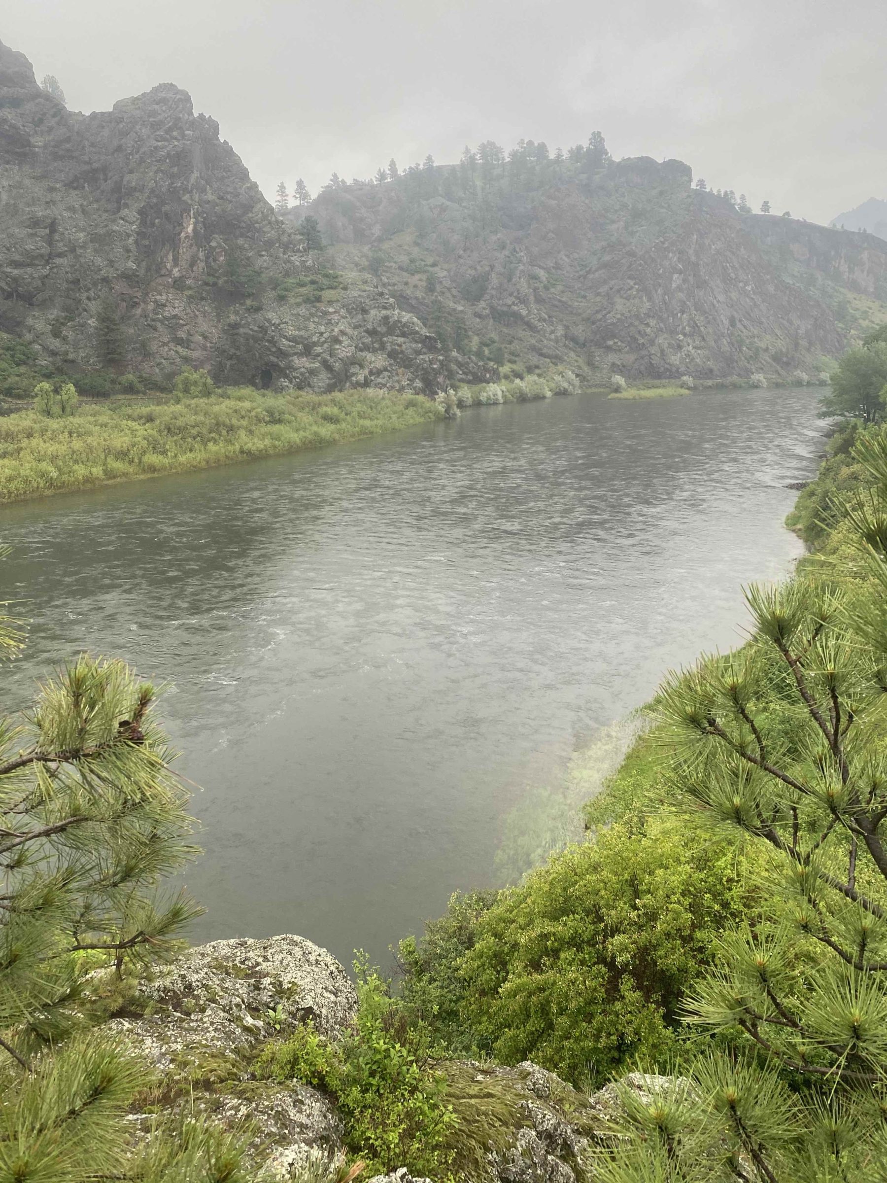
Currently raining hard. 1.65″ in the last 24 hours. More to come. How much? Who knows. Forecast for a another few hours of rain.
Will the Missouri River see more water based on this rainfall.
Simple answer? No.
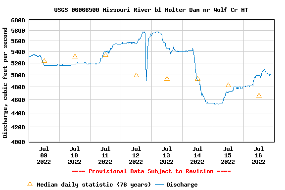
But the gauge is rising currently!? The water level forecast for today and tomorrow stated by DNRC claims we will see a flow of approx 3800cfs. But, that info is subject to change, and may not manifest itself in actual change based on projections. Confusing? Certainly. After all, it is a governmental operation.
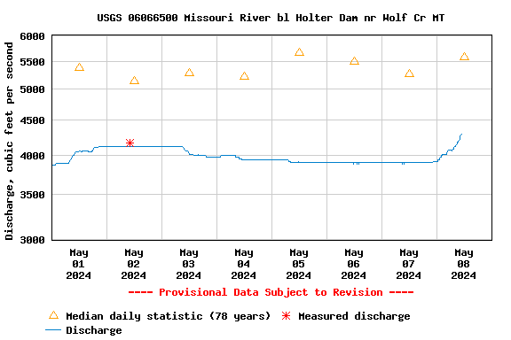
UPDATE-1224pm MST: Just off the phone with Tyler of BOR who is the #1 at River and Reservoir ops. He mentioned that the region of Hauser and Holter could be receiving higher precipitation levels and this current push could be localized and in response to more water, in this immediate area. Yes, the lake above us, and the next lake above us, could be the culprit.
Will the main river blow out because of this rainstorm. No. But part(s) of it may see some color from either the Little Prickly Pear or Dearborn River tributaries.
We believe the gauge movement today and the rainstorm are not connected. But, again, we do not control the knobs.
This, the river primary, will not see a major move in levels based on this rainfall. The upper river region, Bozeman area with the Madison, Gallatin, and Jefferson creating the Mighty Mo at Three Forks, has received more than 6″ of snow in the last 8 hours. Will it continue? Ohh, maybe. Bozo sits near the mile high mark. The region/drainage above, the Rockies, is above the 5280′ mark.
How much will the upper region, the feeder rivers, receive is a mystery. So far we have not witnessed a normal run-off period as the snow has come off slowly. And not a full compliment of winter snow falls or snow on the ground as of April 15th.
A couple rain events like this one could move the needle. But generally, not a single event.
This storm with considerable precipitation will add to the coffers. How much? we will have to wait and see. More rain today, more eater later in the year.
Remember that we have 3 impoundments above us here in Craig Montana. Canyon Ferry Lake, Hauser Lake, and Holter Lake filter the run-off color and waters. So if the Madison is running muddy, or the Jeff, or the Gallatin…that snow, rain, wintry mix has lots of time, days, to filter out the color, and the water. It moves through those lakes/impoundments and settles out the unstable matter in the water column.
We are behind in our annual snow fall. Coming in this year of 2024 at about 70%-80%. This storm, this excess water, will stay in this lakes for the time being. Adding to our later summer flows. Yes, not today, but later down the road, or river I guess is the appropriate word here.
This is a big, giant, large system that services and drains 13,000 square miles of territory to this point, at Holter Dam. That is a large region that can suck up/absorb this water, as it comes in contact with the ground. I believe we are behind, below average in our regional ground water content. Ground Soils harbor water. And some of this water will re-fill the ground water banks. A healthy system includes some level of ground water saturation. And we were behind on this number.
But we get back to us, here locally, and the Missouri River below Holter Dam. I doubt they will push this water through the system. If the reservoirs were full, or near full, we may see a slug of water get passed through. But they are not full. The lake that holds the water, Canyon Ferry, is not full. Filling Canyon Ferry is scheduled, for the 4th week of June. That is better than 5 weeks from now. We are not near that date, or water level.
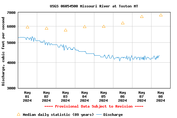
The gauge at Toston, the inflows we follow, that is the inflow point of Canyon Ferry reads today at 4330 cfs. The normal historic flows read approx 3K higher. No danger here. If you want to see seriously high and flood conditions of years past, go ahead and search the database on the USGS site(s). You will see a big difference in this calendar year ’24, in juxtaposition to ’18, ’15, 08′-’11, ’97-’98. Or even years that surprised us. An easy historical view of the past 89 years available on the USGS site(s).
The gauge at Holter Dam is moving upwards. Based on this storm? Our guess, this authors, guess is that we will not see the effects of this storm through the dam. But, Mother Nature is one tricky gal. Been fooled plenty of times before, and will undoubtedly get tricked again! No question.
We will, or may see the effects of the smaller feeder creeks and rivers. Yessir. That may happen.
How long will LPP and the Dearborn affect water color? 1-3 days? Getting much warmer as the week moves along. Hump day, the rain day, is followed by air temps moving upwards towards the mid 70’s this weekend.


Will the water color be affected enough to deter use below the confluence(s)? Oh, probably. Maybe. We will see.
May is the second wettest month in our region. June is the wettest with one 3″ ushering in our greenest month!
Headhunters Fly Shop is your entertainment, information, education, and information source of all things Missouri River. Other outlets serve coffee drinks. Great if you need a bump. Not as much help in the trout intel world. We love to give you the historical perspective. Boots on the ground. Longevity in and on a resource. The data. The info. The facts. And our educated guess-work.
Call for the up to the minute fishing report 406-235-3447 ext 2. Call for the recorded long form 4 minute voice recording fishing report updated today 406-235-3447 ext 3.
BTW: Free coffee at HH of Craig. Yessir, free, average, brewed coffee.

